
Map Configuration — Trackless Mode
In trackless mode, the map serves as a platform for configuring paths, stations, and raw maps based on the actual environment. The raw map is crucial for AMR localization — the AMR relies on recognition of natural features (walls, pillars, etc.) detected by lidar to determine its position.
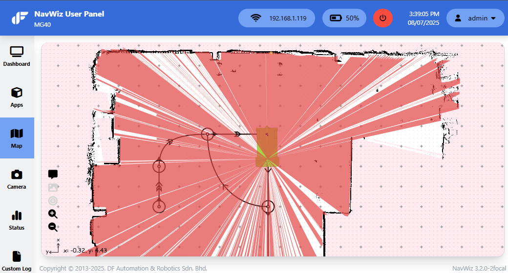
Raw Maps are the lidar scans of the environment. Each raw map entry shows its name, creation time, and allows opening the Raw Map Editor or deleting the map.

The Raw Map Editor is the tool for creating and editing raw maps. Editing the raw map improves localization performance and accuracy. Key tools:
| Tool | Description |
|---|---|
| Save | Save edits. A Soft Reboot is required for changes to take effect |
| Replace original | Tick to overwrite the original raw map instead of saving a new copy |
| Upload/Download | Upload or download raw map files |
| Draw tools | Draw black lines, hollow rectangles, white rectangles, or erase |
| Ruler | Measure distances on the canvas |
| Rotate | Rotate the entire raw map (may reduce quality — consider remapping with proper alignment) |
| Resize Canvas | Adjust canvas dimensions (dX, dY in meters), resolution (m/pixel), and offsets |
| Darken | Convert pixels below a threshold to true black — AMCL only considers true black as obstacle references |
| Undo/Redo | Undo or redo map edits |
| Live App | Connect to AMR for real-time position overlay and position reset |
The Trackless Map Editor extends the track Map Editor with additional tools:
| Tool | Description |
|---|---|
| Landmark Placement | Place reflector landmarks for improved localization accuracy |
| Forbidden Zone | Define zones the AMR cannot enter during Dynamic Path Navigation (requires NavWiz version with dynamic path planning) |
| Path Type Toggle | Switch between Track Path, Trackless Path, and Dynamic Path |