
Laser Sensor Configuration
The Laser Sensors page (ConfigPanel > Laser Sensors) provides a platform to configure up to 31 laser sensing areas per lidar sensor group. Each area defines three detection regions — Near, Middle, and Far — that trigger obstacle responses (Near Block, Middle Block, Far Block) during navigation.
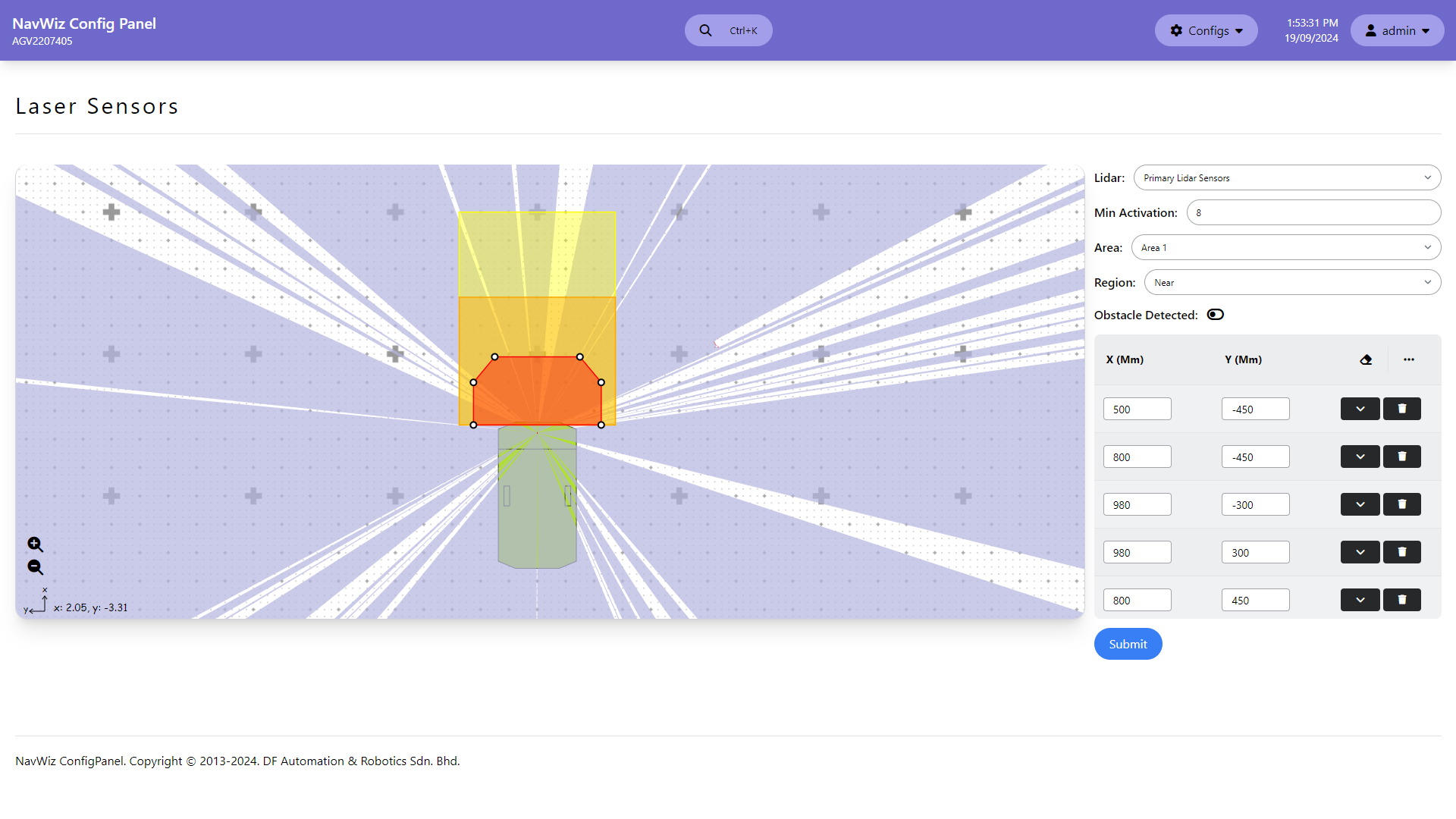
| Setting | Description |
|---|---|
| Lidar | Select the lidar sensor group to configure |
| Min Activation | Number of laser data points inside a region before it is considered an obstacle detection. Each group can have a different value |
| Area (1–31) | Select which of the 31 areas to configure |
| Region (Near/Middle/Far) | Select the region type to edit. Each region is defined by X/Y vertex coordinates (in millimeters) forming a polygon |
Regions are edited by dragging vertices on the visual editor. Click on the edge of an active area to create a new corner point. The X/Y coordinate table on the right updates in real time as vertices are repositioned.
The Obstacle Sensor Parameters (/agv_obstacle_sensor) define which laser areas are used during different movement types. Users can configure up to 10 profiles (AMR defaults to Profile 1). Each profile maps laser sensing areas to movement conditions: forward, reverse, rotate left/right, approaching endpoint, manual control, and dynamic navigation — separately for front and rear sensor groups (A, B, C).